Two geologists at Rice University, Hongbo Ma and Jeffrey Nittrouer, have developed a formulaic system to predict and mitigate the frequent flooding of the Yellow River, or Huanghe in Chinese.
Ma is a postdoctoral researcher from China who joined Rice University in 2014.
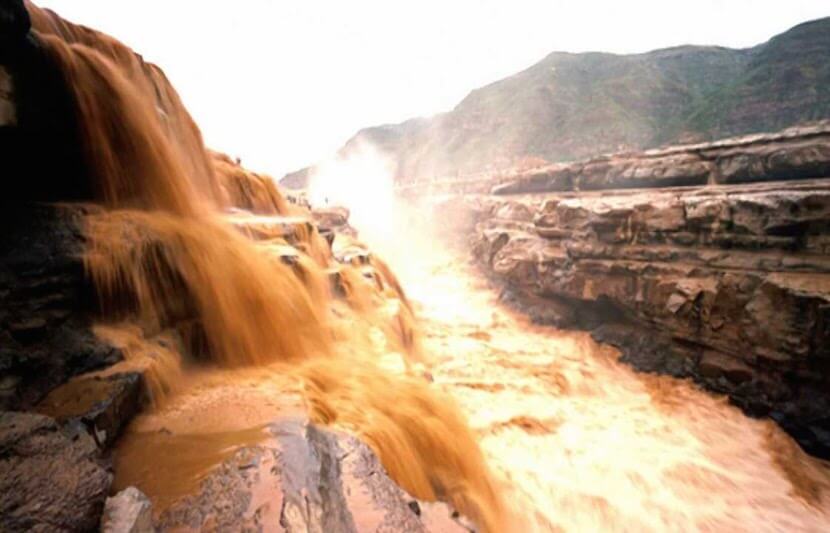
The Huanghe is the third longest river in Asia and one of the world’s most destructive rivers.
It is known for its ability to carry a large amount of silt. Annually, the river carries about 1.52 billion tons of silt per year, which is about 57 pounds of silt per cubic yard of water.
The river carries the highest concentration of sediment load compared to rivers worldwide. Factors that contribute to this large transport of sediment loads includes steep slopes, lack of forested areas, and rapid currents.
The Huanghe has been the leading cause of some of the deadliest natural disasters in the world, killing hundreds of thousands to millions of people as a result of deadly floods. Over 80 million people live in the floodplain, and are threatened by the flooding of the Huanghe.
But now Ma and Nittrouer have created a new tool that could help Chinese officials better predict and prevent the Huanghe’s frequent floods.
Using 3D river-bottom mapping and sediment sampling, Ma and Nittrouer created a sediment transport formulation that can be applied universally to understand coastlines worldwide. This formula is the first model that accurately describes how the Huanghe carries sediment.
Ma and Nittrouer visited the Huanghe in 2015 to begin their four-year study, which was funded by the National Science Foundation (NSF). The goal of their research was to examine the current system that controls the river and directs the growth of the delta into the Bohai Sea.
The researchers hope to lessen the effects of flooding and to establish a formula that is applicable to river systems worldwide.
“If poorly managed, the sediment can be left over the river channel, clogging the river and causing severe floods to damage the surrounding society. Our new finding can help river managerial officials to better control the water flow so as to properly transport the sediment and prevent the flood events,” said Ma.
The researchers compare the Huanghe to the Mississippi River.
“What we found is that for the fine-grained (very fine sand to silt) river system, like Huanghe, China, the channel bed tends to be flat, contrasting with the sandy River system (Mississippi River) whose bed is covered by dunes like the sand dunes in the desert,” Ma said.
“The dune-covered bed is like a bumpy road: no cars can travel fast. The sediment transport rate is thus low, but the flatbed of the fine grain river is like a good highway: cars can travel fast! The sediment transport rate is thus 10 to 100 times higher than that over bumpy, sandy bed.”
Ma decided to be a sedimentologist after the deadly 2008 Sichuan earthquake in China. His goal is to create technology to prevent floods.
While implementing this system may sound difficult, it can be a quick and cost-efficient process, Ma said.
Our new finding is like a physical law: it was not invented but discovered and it is everywhere. Implementing it can be very quick and cost nothing. Our physical law can tell how much sediment can be carried by the river water flow (or any other flow current). So given the water flow and sediment grain size conditions, like water depth, flow velocity etc., we can more accurately calculate the sediment amount in the river instantaneously, costing no time nor money.
For the formula to be effective, it is important to look at the sediment and water flow along with the coastline.
“To really produce a meaningful prediction for human society, we need to put this finding into a framework or a background,” said Ma.
“For instance, sediment in the rivers is the major material building the delta coastline, so if we can accurately calculate how much is conveyed by the river to the delta and coastline, we can predict the coastline’s future and understand how much sea level rise will erode our coastline more accurately.”
Ma believes that the formula will be invaluable for the future of residents of the Huanghe’s floodplain.
“What it means to local people and managerial officials is that they can use our findings to understand fine grains are sometimes not bad, which enhance the sediment transport rate greatly and prevent the elevating river channel to induce floods and to better control the water and sediment to maintain an unobstructed river channel,” he said.
“Preventing potential flooding hazards can benefit the 88 million people, living along the bank lines of the lower Yellow River, China.”
In addition to Nittrouer and Ma, the research team included Andrew Moodie from Rice University, Kensuke Naito and Gary Parker from the University of Illinois at Urbana-Champaign, Xudong Fu and Baosheng Wu from Tsinghua University, and Yuanfeng Zhang and Yuanjian Wang from the Yellow River Institute of Hydraulic Research.
The research is supported by the National Science Foundation and the National Natural Science Foundation of China.